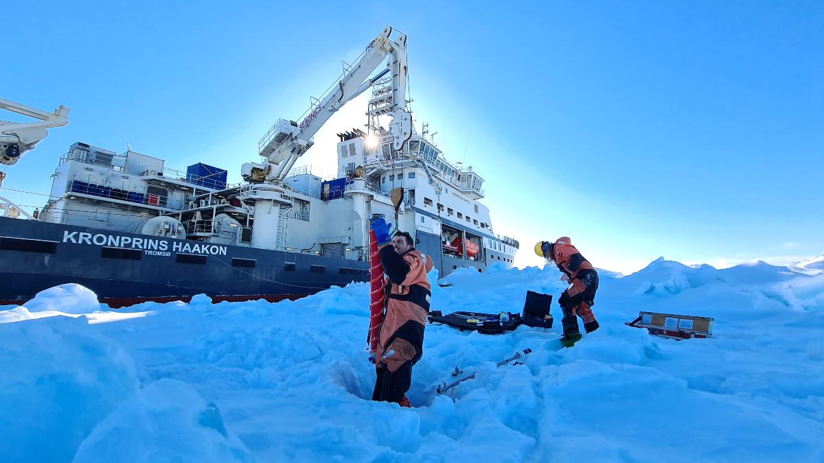
Measuring Arctic sea ice thickness all year round
Using satellites, we are now able to measure the thickness of Arctic sea ice – also in the summer. This is crucial for both shipping in the Arctic and future weather and climate forecasts. The solution was developed by an international team, led by researchers at universities in Tromsø and Bristol.

“The Arctic ice is melting faster than ever. We need knowledge about the thickness of the sea ice, both to reduce safety risks for businesses and shipping in the Arctic, but also to make forecasts for the future climate,” says team leader Jack Landy at the Department of Physics and Technology at UiT The Arctic University of Norway, who began the work while at the University of Bristol.
The research team has developed the first dataset showing the thickness of sea ice across the entire Arctic and through a whole year. The results were published in the journal Nature in September 2022.

Satellites are dazzled by the melting ice
Satellites have been used to measure the thickness of ice in the Arctic since the 1980s. But the technique has only worked in winter, from October to March, when the ice and snow are cold and dry.
“In the summer months the satellites are dazzled by ponds of snow and ice meltwater that pool on the sea ice surface. Then they have been unable to distinguish between melting ice and water,” says Landy.

To solve the problem, the researchers adopted Artificial Intelligence (AI) and examined previous data from the satellites. Now they know when the satellites register ice and when they register ocean.
In addition, the team has constructed a new computer model of the satellite sensor, to make sure it is correctly measuring both the thickness of the ice and how far up it floats over the sea surface.
This is good news for the shipping industry.

Safer to sail in Arctic Waters
Shipping in the Arctic has increased rapidly in recent years, because of the ice melting. Particularly in the Barents Sea and close to Svalbard, shipping activity is high during summer. To sail safely, navigators need information about where there is ice and how thick it is, in advance.
The Norwegian Meteorological Institute provides sea ice forecasts for the Arctic but has lacked reliable data on ice thickness in the summer months.
Using the new satellite data, we are finally able to make sea ice forecasts informed by the ice thickness, not only for the winter, but also for the summer. This will reduce safety risks for ships and fishing boats.
Jack Landy
“We can also predict whether there will be ice or not at a given location in September, by measuring the ice thickness in May,” he says.
Increased understanding of the climate
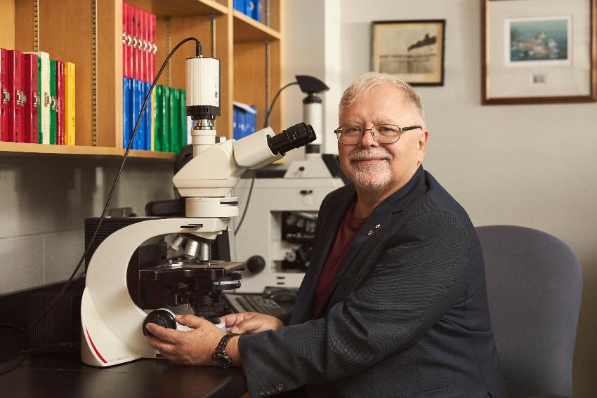
According to Associate Professor Dr Michel Tsamados from University College London, the findings are also of great importance for our understanding of both weather and climate.
He is one of the researchers behind the study and explains that use of the new data in climate models can give us better forecasts.
When we use the new ice thickness data in advanced climate models, it will improve both our short-term forecasts for the weather at the mid-latitudes and the long-term forecasts that show what climate we will have in the future.
Michel Tsamados
Further reading:
Landy JC, Dawson GJ, Tsamados M, Bushuk M, Stroeve JC, Howsell SEL, Krumpen T, Babb DG, Komarov AS, Heorton HDBS, Belter HJ, Aksenov Y (2022) A year-round satellite sea-ice thickness record from CryoSat-2. Nature 609: 517-522, https://www.nature.com/articles/s41586-022-05058-5
See also the Norwegian Meteorological Institute’s sea ice forecasts at https://cryo.met.no/en/short-range-sea-ice-forecasts
-
Fiskeri- og havbruksvitenskap - bachelor
Varighet: 3 År -
Fiskeri- og havbruksvitenskap - master
Varighet: 2 År -
Akvamedisin - master
Varighet: 5 År -
Bioteknologi - bachelor
Varighet: 3 År -
Arkeologi - master
Varighet: 2 År -
Musikkteknologi
Varighet: 1 År -
Computer Science - master
Varighet: 2 År -
Geosciences - master
Varighet: 2 År -
Biology - master
Varighet: 2 År -
Technology and Safety - master
Varighet: 2 År -
Physics - master
Varighet: 2 År -
Mathematical Sciences - master
Varighet: 2 År -
Biomedicine - master
Varighet: 2 År -
Computational chemistry - master
Varighet: 2 År -
Biologi - bachelor
Varighet: 3 År -
Medisin profesjonsstudium
Varighet: 6 År -
Luftfartsfag - bachelor
Varighet: 3 År -
Arkeologi - bachelor
Varighet: 3 År -
Informatikk, datamaskinsystemer - bachelor
Varighet: 3 År -
Informatikk, sivilingeniør - master
Varighet: 5 År -
Geovitenskap- bachelor
Varighet: 3 År -
Biomedisin - bachelor
Varighet: 3 År -
Kjemi - bachelor
Varighet: 3 År -
Samfunnssikkerhet - bachelor
Varighet: 3 År -
Matematikk - årsstudium
Varighet: 1 År -
Ergoterapi - bachelor
Varighet: 3 År -
Fysioterapi - bachelor
Varighet: 3 År -
Radiografi - bachelor
Varighet: 3 År -
Automasjon, ingeniør - bachelor (ordinær, y-vei)
Varighet: 3 År -
Samfunnssikkerhet - master
Varighet: 2 År -
Farmasi - bachelor
Varighet: 3 År -
Farmasi - master
Varighet: 2 År -
Religionsvitenskap - årsstudium
Varighet: 1 År -
Romfysikk, sivilingeniør - master
Varighet: 5 År -
Klima og miljøovervåkning, sivilingeniør - master
Varighet: 5 År -
Bærekraftig teknologi, ingeniør - bachelor
Varighet: 3 År -
Forkurs for ingeniør- og sivilingeniørutdanning
Varighet: 1 År -
Odontologi - master
Varighet: 5 År -
Filosofi - bachelor
Varighet: 3 År -
Anvendt fysikk og matematikk, sivilingeniør - master
Varighet: 5 År -
Praktisk-pedagogisk utdanning for trinn 8-13 - årsstudium (deltid)
Varighet: 2 År -
Internasjonal beredskap - bachelor
Varighet: 3 År -
Datateknikk, ingeniør - bachelor (y-vei)
Varighet: 3 År -
Droneteknologi, ingeniør - bachelor
Varighet: 3 År -
Bygg, ingeniør - bachelor
Varighet: 3 År -
Bygg, ingeniør - bachelor
Varighet: 3 År -
Bygg, ingeniør - bachelor (y-vei)
Varighet: 3 År -
Datateknikk, ingeniør - bachelor
Varighet: 3 År -
Datateknikk, ingeniør - bachelor
Varighet: 3 År -
Elkraftteknikk, ingeniør - bachelor
Varighet: 3 År