Tirpitz Site Project
During WWII, the Tirpitz posed a significant threat to Arctic and was repeatedly attacked by the Royal Navy and Royal Air Force, and Soviet Air Force. Finally sunk in 1944 by the Royal Air Force, the ship´s remains were then salvaged with vast amounts of non-commercial material being dumped on the seabed. The Arctic Legacy of War, Tirpitz Site Project is utilising remote sensing and aerial and underwater robots. It is a multidisciplinary endeavour that includes science, technology, archaeology and historical research to record and monitor the site. There is also a humanities and social science, and educational component to the project. This combined research will be used to consider the site's heritage values, and evaluate the environmental risks posed by this legacy of war.

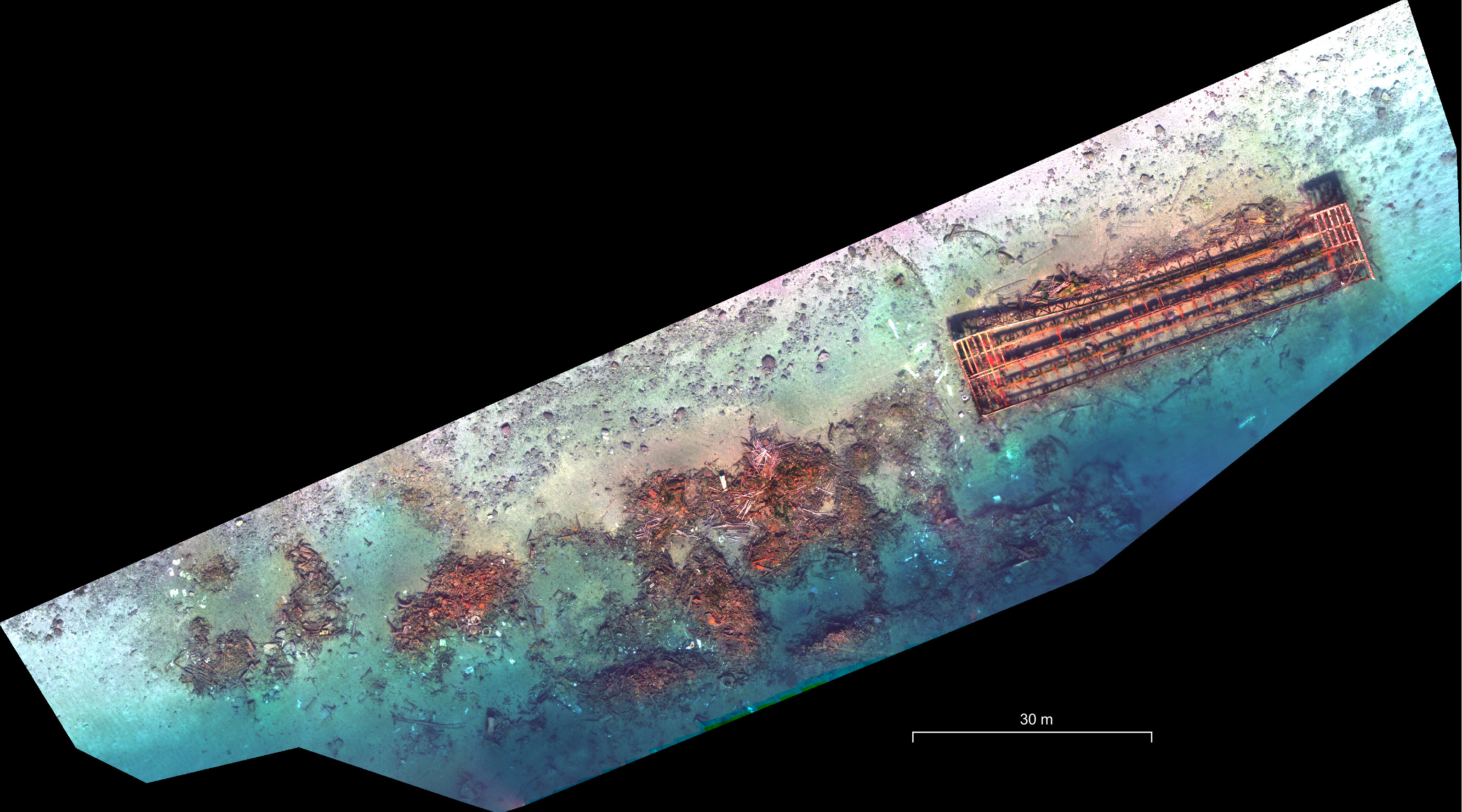
Natural colour orthoimage image (extract) from aerial surveys on 28.03.2023 using a Phantom 4 UAV with a multispectral imager. The orthoimage, with a spatial resolution of 2.5 cm, will be used for a bathymetric map to accurately estimate the area covered by the Tirpitz debris. Image processing: Dr Olga Tutubalina and Professor Gareth Rees (Scott Polar Research Institute, University of Cambridge). Image acquisition: Markus Dreyer, aerial images; Martin Bjørndahl, supporting underwater images (UiT The Arctic University of Norway).
The Tirpitz Site Project is a joint research endeavour between UiT The Arctic University of Norway and the University of Cambridge’s Scott Polar Research Institute.